Table of Contents
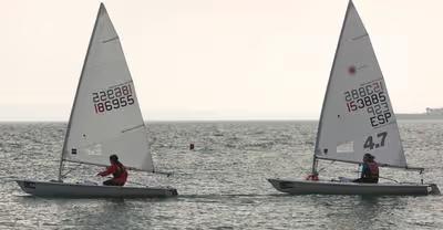
What are the Best Sailing Apps?
Smart sailing applications have quickly become essential for comfortable and safe yachting. They're precise, simple to use, and incredibly useful for critical duties that assure boating safety and cruising holiday enjoyment. They also save you a lot of room on board that a traditional instrument would otherwise take up.
There are some very wonderful apps for sailors and boaters available these days. We've selected ten of the greatest sailing applications, ranging from weather and tides forecasts to route planners and maritime traffic, knot instructions, and real-time language translation.
Savvy Navvy
Savvy Navvy is a smart app with all of the important information at your fingertips, ready to be turned on or off. It's the only app with a routing algorithm that can create paths by taking wind and current data in your area in real-time. The ability to enter later or earlier departure timings and monitor the impact on wind and tide is really handy.
The charts are a touch sparse in detail but are good enough to help in navigation. The sophistication of the seamanship has not matched the intricacy of the programming for Savvy Navvy's route planning. It calculates impossible-to-extrapolate wind patterns. It employs performance polars that cannot be modified and extrapolates incredibly intricate wind patterns from GRIB data, making the designs intriguing to look at but useless in practice.
BoatUS App
BoatUS membership is similar to AAA for drivers, and it's a great way to add a sense of security to your voyage. Mechanical breakdowns and accidents at sea may be a nightmare, but BoatUS can help alleviate some of your concerns so you can relax and enjoy your time on the water. If something goes wrong and you need help, the BoatUS app allows you access to 24/7 boat towing in a variety of places.
The BoatUS App is an excellent resource for vital nautical data, such as forecasts and small boat advisories, in addition to towing and assistance dockside. With alerts switched on, you'll get a notification whenever a weather authority issues a warning or advisory that you'll need to know about.
With notifications enabled, you'll receive a notification whenever a weather authority issues advice or warning that you should be aware of. BoatUS isn't only about avoiding dangers on the water; they also have wonderful location-based information on cheap goods and services like gasoline and mooring. Locations and costs for services such as boat maintenance, eating, parts, mooring, and fishing information are included in their resources—like having a local guide in your pocket.
They also feature a map of West Marine locations so you can get extra parts or accessories for your boat when you're not in town. You may use it to broadcast your whereabouts on social media with friends and family, as well as automatically through SMS and location so that someone is constantly aware of your current location. This comprehensive and handy sailing software is free for iOS and Android users; however, towing services need registration.
Seapilot
This sailing app does precisely what the name suggests; it helps you pilot your vessel through unfamiliar waters. While others may disagree, we’ve found this tool to be unintuitive to use. It is based on several elements of professional ECDIS charting systems and, in many respects, has some of the greatest capabilities.
The main issue is that the auto-zoom feature on the charting detail doesn't work in many areas. There wasn't much you could accomplish until you zoomed in to a tiny region since there was so much clutter on the screen. Even when zoomed in, navigational markings were frequently overlapped with spot depths, rendering both hard to see. Seapilot recognizes that the usage of ECDIS data causes this problem in some areas and wants to address it in the future.
Knots 3D
Sailboat rigging is more simple than ever before, thanks to meticulous boat design and engineering. Sailing vessels in the past had enough rope to please any scoutmaster, but it's now much simpler to sail without having to manage too many ropes. Even new gear, though, needs a certain level of knot knowledge.
A faulty dock tie-up might cause your boat to break away and drift, and improper knot tying can be deadly at sea. Furthermore, who wouldn't want to impress the men at the yacht club with their knot-tying skills? With the Knots 3D program, you can quickly learn and master over a hundred important sailing knots. This sailing app is an absolute must-have, especially because it gives you a three-dimensional picture of the knot-tying procedure.
This program lets you see the knot-tying procedure in three dimensions, which is far more convenient than gazing at a static book page. You can also utilize the program to strengthen your existing talents, and it will make you appear like a pro when docking. The Knots 3D app is available for both Android and iOS devices.
Fast Track GPS
Another excellent GPS and navigation app for sailors is this one. The program is called Fast Track GPS, and it has a lot of useful navigational features for sailing and boating. Like most standard GPS applications, it has real-time location services to act as a cross-reference with your major navigation systems.
It also contains an extensive database of waypoints to help navigate locations where the information may be a little hazy. When other weather data is missing or unclear, the FastTrack GPS app also includes real weather information and predictions to assure safe travel. This software allows users to identify and store their exact location, making it easier to keep track of where they're going and where they've been so far. Live wind direction is also included in the app, which is just another nifty feature that you can use while out in the open waters.
It also contains real-time wind statistics to assist you in determining where to travel and when to tack. You can use this app as a proximity-alert device in addition to an onboard radar system to help avoid accidents with the coast or dangerous and shallow seas.
Charts, a suitable navigation system, and a person on the lookout in case someone makes a mistake are still required for safe navigation. However, this app gives some additional tools that may be incredibly useful, particularly while traveling in unknown locations. The Fast Track GPS Tool is a free app for Android smartphones.
Aye Tides
Tides are one of the most dangerous aspects of sailing. Hundreds of boats run aground or have their hulls damaged every year in shallow water. Many experienced sailors have become stranded at some point during their sailing careers, and it's a major nuisance (if not a significant safety issue) every time it happens.
People usually run aground due to inexperience or a lack of tide information, a reasonable explanation for an accident. You can now get real-time and accurate tide data from over 12,500 places across the world with the AyeTides app. AyeTides takes the guessing out of shallow water navigation. This allows you to avoid dangers and plan ahead of time without having to rely on intricate and unreliable tidal forecasts.
While tidal charts are still required, the app can assist clarify information to help you stay out of potentially dangerous shallow places. AyeTides keeps you up to speed with the greatest available data, so you'll always know what's going on. It can also help you forecast future circumstances, so you can select where to anchor for the night (and where not to).
Navionics Boating App
This app is simple and straightforward to use, which is why it is appealing to beginners. Charts load quickly, and detail auto zooming is definitely the finest in class. Text is employed well and informs you when you need to zoom in to learn more about hazards. Arrows indicating current intensity, direction, and whether the tide is on the ebb or flood are animated.
To receive GRIB/wind data, you have to open a second window, which is inconvenient because it should clearly be an option on the screen. The Navionics Sonar feature allows charts to be customized to display depths based on real-time data from thousands of boats.
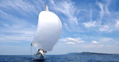
Windy
Windy is a fantastic tool for visualizing weather forecasts and might be the greatest sailing weather app available. Professional pilots, boaters, fishers, governments, and rescue teams rely on this quick, intuitive, thorough weather app. Windy is incredibly dependable, making it one of the greatest sailing applications available. You may use it to plan a trip or determine the ideal week to go sailing. The most recent weather prediction will be provided by Windy. The nicest part about Windy is that it is completely free and has no advertisements.
C-Map
C-MAP makes my favorite charts, with just enough information for spot depths, bigger nautical markings on land and water, and smart coloration. Wind data from GRIB files may be simply superimposed, and the color shading technique makes it simple to discern expected wind speeds while also discouraging users from extrapolating exaggerated detail.
However, there is no tide or current overlay, which is inconvenient for sailors, and there is no satellite imagery overlay, which is disappointing. C-automated MAP's routing system is quite simple to use. However, after allowing me to choose a minimum depth of 3m; it would offer routes that violated this restriction while also providing a second option that did not.
PredictWind
Another wonderful weather software for sailing, with plenty of useful options to keep you informed. This isn't your typical weather software; it includes full-resolution maps, tables, and charts updated in real-time. You can watch real-time wind speed and direction information on an interactive map and temperature data and live forecasts with the PredictWind app.
This software employs a patented PWG and PWE maritime weather monitoring system, as well as ECWMF and GF5 models, to provide pinpoint accuracy, dependable forecasts, and high resolution. Furthermore, the app is meant to be simple to use, allowing you to quickly locate and analyze key weather data. This is a really useful program to have on hand, and it can assist you.
Furthermore, the app is meant to be simple to use, allowing you to quickly locate and analyze key weather data. This is a really useful program to have on hand, and it may assist you in charting a confident route. The best part is that you can use this incredible app for free on iOS and Android devices.
No Foreign Land
Don’t be fooled by the name; No Foreign Land is great for sailors who are out at sea as well. This app is a rich mine of information regarding anchorages, and I save it and use it frequently! It's a type of anchoring and marina review site where people may share their experiences and relevant information.
You can register your boat and check in to the anchorages you arrive at, which is a nice feature not seen in other sailing applications, especially for families, so you can locate other cruisers with similar interests and say hello.
People frequently include their children's ages so you can quickly connect with other sailing families. You can track boats you're familiar with to check if you're in the same area as buddies you've made. It also maintains your path so you can see where and when you've arrived at various anchorages, which we find to be a pleasant little memento of our adventure thus far.
It's always improving, so new information is being added to anchorages like if there's water and power, where to get washing services, and other essential items like groceries and vehicle rental. If you have a blog, you may include links to pieces you've written about your travels. There are so many aspects that I'm still learning about — the admins are quite helpful and will walk you through anything if you get lost.
Google Earth
You'll want to make sure you are somewhere where the anchor will dig straight in and hold well if you anticipate strong winds. Navily or No Foreign Land will occasionally detail the bottom, but not always. That's where our good friend Google Earth comes in handy. Google Earth shows a number of anchorages and shallow channels, so you can go to an anchorage and discover that spot of sand even in the dark. It's a surprisingly handy tool for sailing that we highly suggest.
Recent Articles